![[OLD FALL 2018] 15-104 • Introduction to Computing for Creative Practice](https://courses.ideate.cmu.edu/15-104/f2018/wp-content/uploads/2020/08/stop-banner.png)
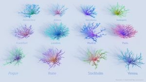
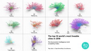
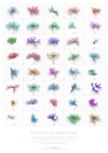
Coral Cities is a project by Craig Taylor that visualizes cities in a unique way. Cities are usually mapped by their buildings, streets, and popular nodes; however, Taylor wanted to show how liveable a city is. He used raw data (such as crime rate, education, political stability, traffic, etc.) to generate a geo-spatial analysis of cities today, visualized as these coral structures.
This post by fellow architecture student Curran Zhang really stood out to me because of the emphasis in our field for mapping. We have been taught to try to find unique ways to map raw data, and Craig Taylor’s Coral Cities really offers a unique representation that could be interpreted in many different ways.
https://towardsdatascience.com/coral-cities-an-ito-design-lab-concept-c01a3f4a2722