![[OLD SEMESTER] 15-104 • Introduction to Computing for Creative Practice](https://courses.ideate.cmu.edu/15-104/f2022/wp-content/uploads/2023/09/stop-banner.png)
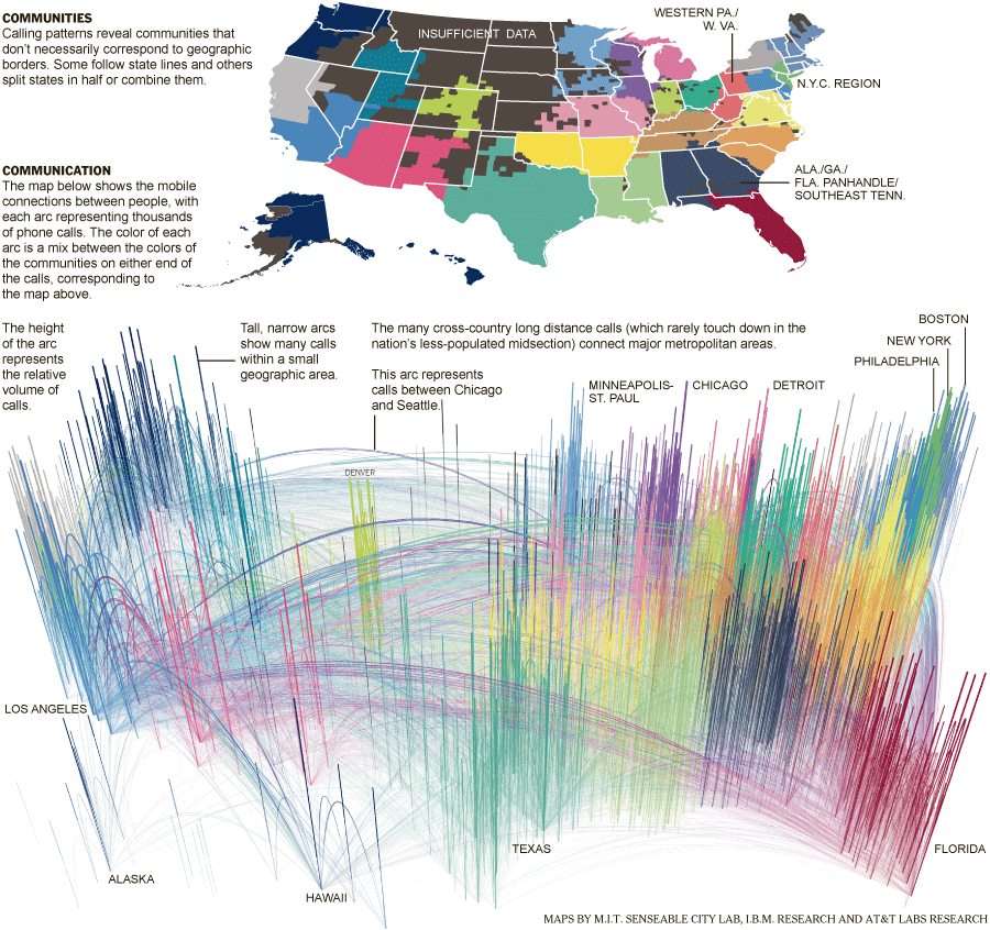
I admire the phone-Call Cartography project by the New York Times in 2011. The aggregate cell phone traffic data from the United States in July of 2010 was analyzed by researchers from M.I.T., AT&T and I.B.M. It shows how cities have become hubs and connect to other parts of the country. These communities shown by different colors on the map have little to do with geographic boundaries. I admire it because it shows patterns of how people are brought together over long or short distances. I think the creators’ artistic sensibilities are shown in the way this enormous amount of data is visualized. For example, the colors used, the areas drawn together, and the focus of the maps. Although, I think it could have been clearer in the second map which lines are connecting different places. Many of the lines are lost because they are too thin, or the colors blend together. Also, it is different to tell where they end because of the angle of the map and because there is no real map underneath, the reader is left with minimal text and shapes as reference.