![[OLD FALL 2020] 15-104 • Introduction to Computing for Creative Practice](https://courses.ideate.cmu.edu/15-104/f2020/wp-content/uploads/2021/09/stop-banner.png)
I’m inspired by the interactive map initiative, Dashilar, created by Hara Design (Kenya Hara, Hiroaki Kawanami, Hiroyuki Saito, Sohei Takimi.) Link to project brief: https://www.ndc.co.jp/hara/en/works/2014/08/dashilar.html.
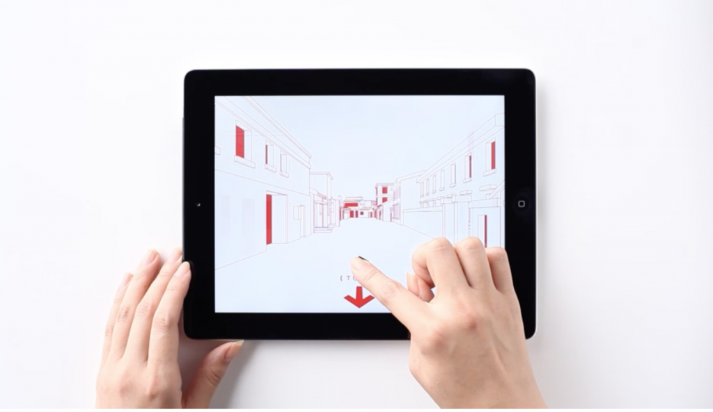
I’m impressed by the practicality of this product, as it aims to educate and (digitally and physically) guide people about and through the city of Dashilar, the elegant aesthetics, respect to Chinese culture, and also its versatility and lasting potential in the form of physical products like signage and wrapping paper. Coming from a fine arts background, I appreciate traditionally “beautiful” things– however, learning design has made me start to think about how aesthetics can be translated into means of problem-solving, which this interactive map does beautifully and with consideration. I’m not familiar with the process of the creation of this project, but I’m positive complex code was used to create the streamlined zooming in/out function of the map, changing perspectives of the buildings depending on how you pan on the map, etc. The project’s creators may have been inspired by Google Maps for its functionality and traditional Asian maps for its visual language. This project points to even more considerate and useful interactive maps, especially for complex and historical landmarks around the world– aiming to educate visitors thoroughly about the historical significance of different places while effectively guiding them during their trip.