![[OLD FALL 2020] 15-104 • Introduction to Computing for Creative Practice](https://courses.ideate.cmu.edu/15-104/f2020/wp-content/uploads/2021/09/stop-banner.png)
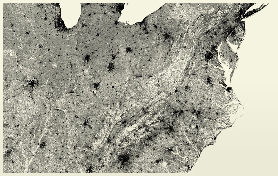
Ben Fry’s piece called All Streets was created on April 24, 2008. It is compilation of 240 million segments of road compressed into the shape of the United States continent. Ben was joined by three teammates – Katy assembled high-resolution images for offset printing, James made sure that the prints’ densities were appropriate for the piece, and Chris helped write software. This software created tiles that could be combined into a high-quality, HD image.
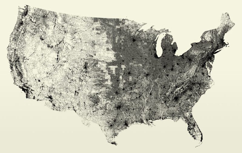
I admire this aspect of the project because compiling such an enormous amount of images into one is a feat, considering that most software has a hard time dealing with images more than 30,000 pixels wide. The software program that he developed is called Processing, an open source programming environment that allows for computational design and interactive media. His artistic sensibility in processing and visualizing data is clearly manifested in the final form of this piece. His interactions with informational data is transformed into piece that takes millions of individual road segments into one unified artwork.