I proposed to create a typology of surveillance power by building facial recognition recognition. That is, I plan to build a computer vision pipeline that can automatically recognize clippings of surveillance cameras from images of street scenes, and an image classifier that categorizes these segmented images into the kind of camera, their technical capability for facial recognition, and the institution they are owned by and send data back to. This will enable me to automate the creation of both power maps and topographic maps of surveillance, that is: both representations of the relationships between institutions of power the surveillance acts on behalf of, as well as representations of the spatial locations different kinds of surveillance can be found.
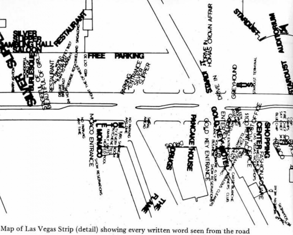
This project is a step toward that. I am inspired by the maps of Manhattan surveillance cameras in the Institute for Applied Autonomy’s Routes of Least Surveillance. This work is also inspired by the Pittsburgh Surveillance Walking Tour made by the Coveilance Collective (of which I am a member). The idea of an abstracted map came from “Learning from Las Vegas” by Denise Scott Brown, Robert Venturi, and Steven Izenour, depicting street signs visible from the Las Segas strip (shown below).
While similarly enthralled with the geography of surveillance and exhaustive geographic accounts of specific features of a place, my new work seeks to build on these projects by recognizing that surveillance cameras are not singular, but varied in their age, technical capabilities, their owner, and who they do and do not share data with. This work seeks to surmise tentative answers from a detailed study of cameras’ outward characteristics.
I had originally intended to build a computer vision algorithm that would recognize surveillance cameras, and classify them according to their capacity to support facial recognition and resulting data owner. However, after attempting to collect training data for this idea, I realized that a more detailed examination of the physicality of the varied cameras that appear in the Pittsburgh landscape was needed. I therefore decided to create drawings of these cameras in three short stretches of street across Pittsburgh.
***
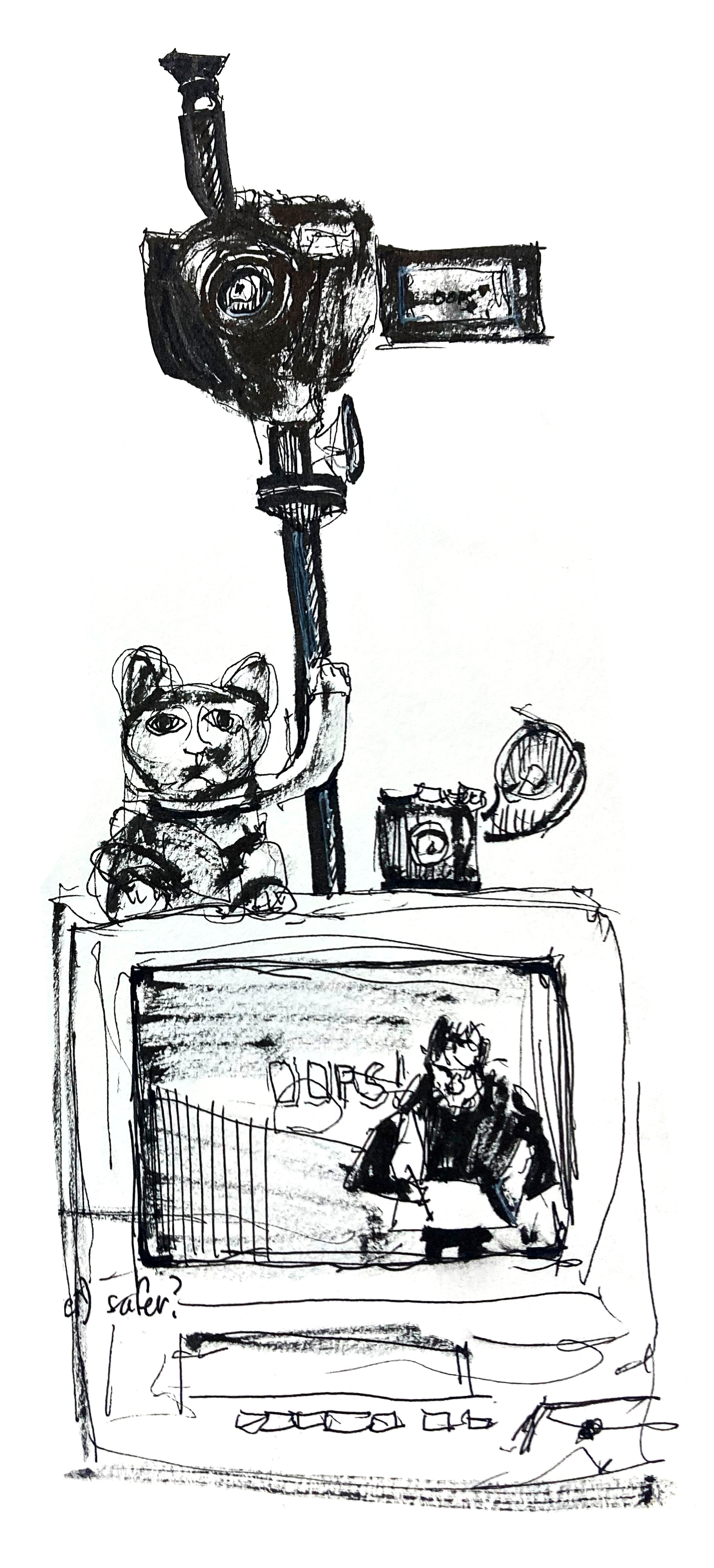
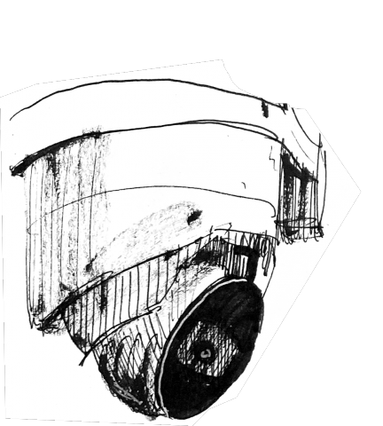
Border of The Hill and Duquesne University Context: The Hill district is a historically Black neighborhood. Just to its southwest tip lies Duquesne University private a predominantly white university.Appears to be mostly older-generation cameras, of uncertain facial recognition ability. Hardened, placed high up on private businesses. PNC bank had a camera swiveling loudly on a timer. Duquesne has a “Blue Light Pole” of dubious effectiveness with a camera towering atop.
***
***
Finally, by placing the camera drawings on correspondent maps, and comparing between these three neighborhoods, I reached tentative hypotheses. As well as being presented here, these maps, drawings, and hypotheses are presented on a poster..
As noted in book Photography and Science by Kelley Wilder, cameras are often used to record the particular, whereas drawing provides a medium suited for drawing the “ideal specimen” by abstracting away extraneous visual information. Also, noticing small differences between ostensibly similar cameras requires a long period of focused looking, the same kind of looking that is required to produce a drawing. In this way, drawing is the appropriate capture technique for this project.
***
Bloomfield Bloomfield is an "up and coming" historically Italian neighborhood, now home to hip bars and restaurants.Many newer generation IoT cameras, higher resolution and internet-connected. Footage could be shared with law enforcement directly though partner programs. Often lower to the ground, more at eyeline. Some video doorbells.
***
***
To produce this project, I meticulously drew every visible surveillance camera on three stretches of street in the areas of Bloomfield, Walnut Street, and the border of The Hill District and Duquesne University Campus. I then carefully digitized these drawings, and put them on a map of where exactly each camera exists. I then wrote a short analysis of the kinds of surveillance technology characteristic to each neighborhood, presented on the poster and interspersed in this blog post.
***
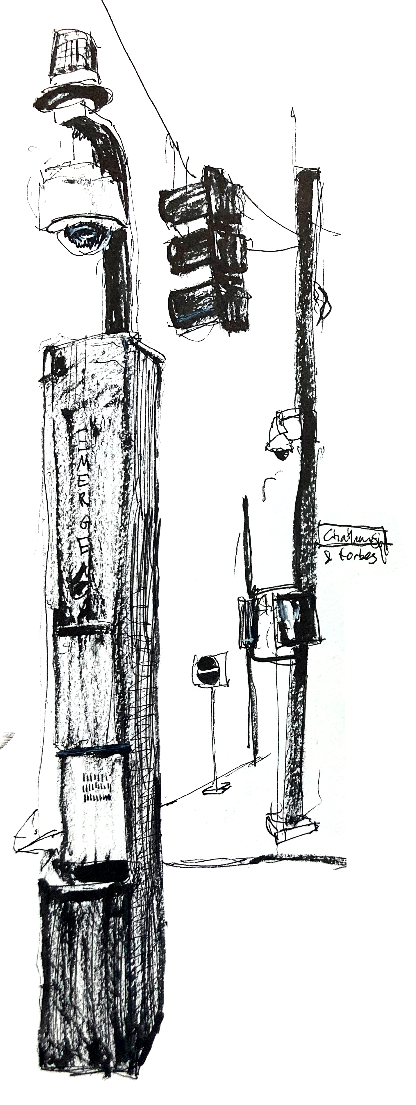
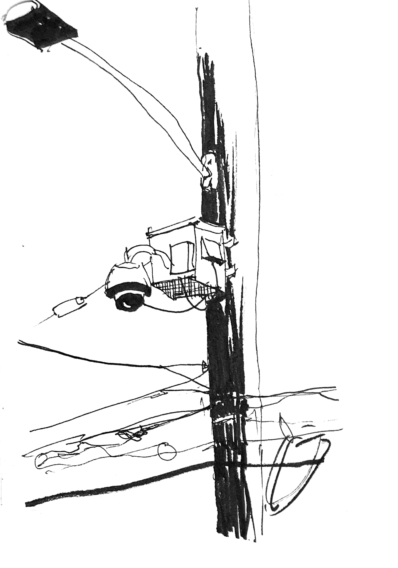
Walnut Street. Context: this is the bougie shopping street. Think Apple, Banana Republic, and overpriced cocktail bars.Lower density of privately-owned cameras. City-owned cameras on utility poles. Highly visible street signs announcing this surveillance. Who gets this data? How?
***
***
I have not yet achieved my goal of building a facial recognition recognition system, by building a computer vision system able to recognize cameras capable of facial recognition. However, this project is a step in that direction, and opens new opportunities, chiefly: When I do build such a system, what can we learn about the different modalities and owners of surveillance, between different neighborhoods?
See the entire full res poster including maps side by side here.
***
David Gray Widder is a Doctoral Student in the School of Computer Science at Carnegie Mellon University where he studies how people creating “Artificial Intelligence” systems think about the downstream harms their systems make possible. He has previously worked at Intel Labs, Microsoft Research, and NASA’s Jet Propulsion Laboratory. He was born in Tillamook, Oregon and raised in Berlin and Singapore. You can follow his research on Twitter, art on Instagram, and life on both.
***
bonus @Bankrupt Bodega: