![[OLD FALL 2018] 15-104 • Introduction to Computing for Creative Practice](../../../../wp-content/uploads/2020/08/stop-banner.png)
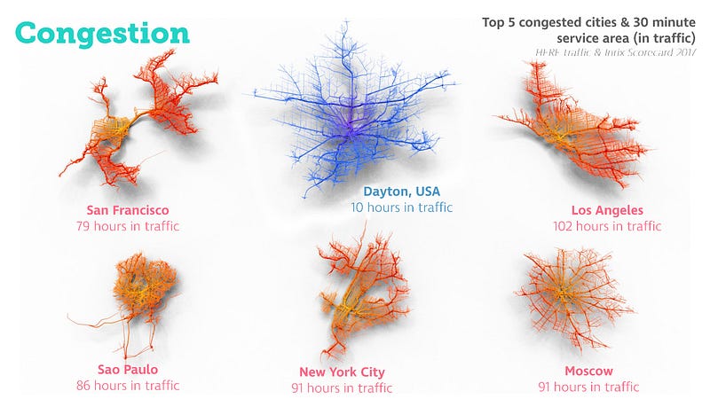
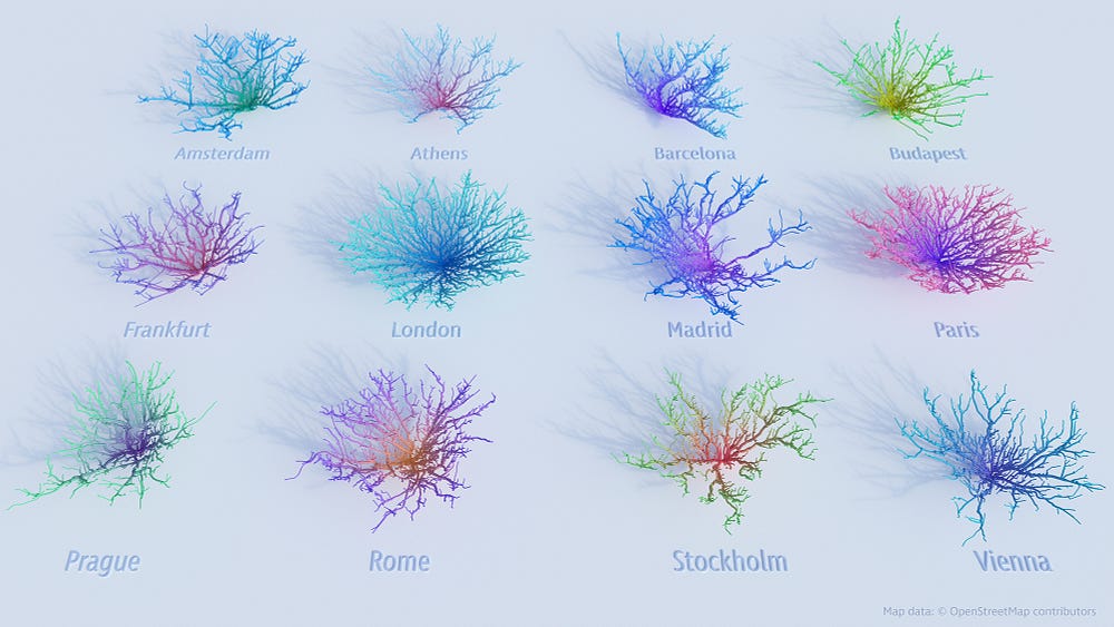
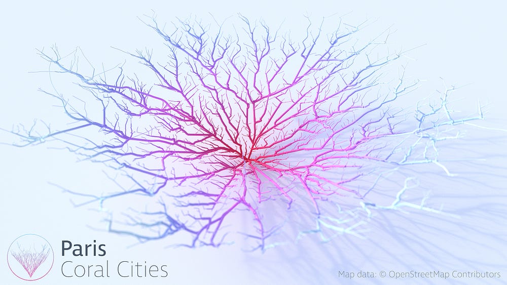
Coral City is a project produced by Craig Taylor that helps visualize a city in a non-traditional way. When we think about a map of the city, we would think about it as a drawing that shows the road, street names, and attractive spots. Craig on the other hand, wanted to use the raw data generate from a regular map and help produce geo-spatial analysis of the cities. Using this way of the representing the city, data such as political stability, crime rate, education, healthcare, and traffic are also used to not only represent the city but also assess how livable the city is.
This project caught my attention because as an architecture student, the idea of mapping is used all the time in every project. The idea of map in our era is no longer the same, generic maps that we grew looking at. With the introduction of new technology and resources, map has taken a more informative and abstract way of being represented. Maps are something that should lure people into understanding the information that is presented.
Reference:
https://towardsdatascience.com/coral-cities-an-ito-design-lab-concept-c01a3f4a2722