![[OLD FALL 2019] 15-104 • Introduction to Computing for Creative Practice](wp-content/uploads/2020/08/stop-banner.png)
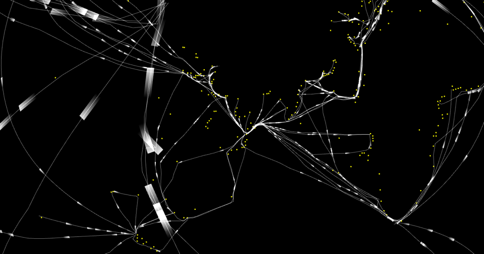
Marcin Ignac create a design project at the Copenhagen Institute of Interaction Design in 2011. The project is called “Sea Transport Network,” in which Ignac took inspiration from traditional route of sea transport and created a bunch of light path that he stated to be traceable based on a real GPS coordinate system .
To generate a piece of art from the sea transport network, Ignac used a series of sea transport data and transformed them into visualization. In the visualization Ignac marked out the important trading cities in a relatively brighter spot and used strand of light to connect those spots. And for the final result, he used computational technology to create a series of videos that shows the flow of transport around the earth. After he hides the earth, all that is left is a sphere that is formed by light spots and stands that simulates the sea transport network.