Project: American Panorama by Stamen Inc.

Stamen is a company that specializes in very unique and data-centered visualizations. Many of their projects are based on geography/mapping.
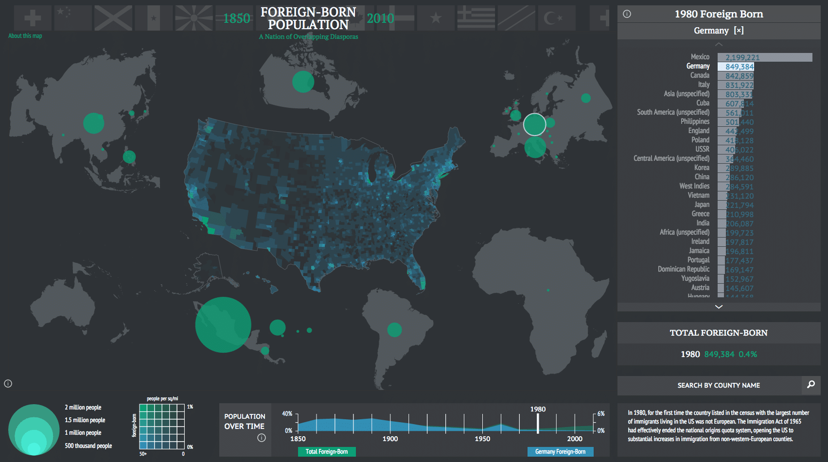
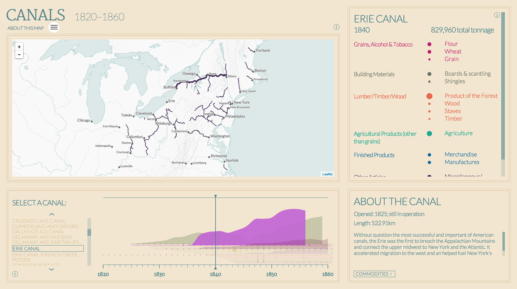
For one of their projects in collaboration with Mellon Foundation, Stamen created a suite of software tools that generate maps! They used their software to make maps that portrayed a diverse set of data about America, such as physical objects (canals and trails) and statistics such as foreign-born populations in America. The creators’ artistic sensibilities are portrayed in the different aesthetic choices of the maps, such as color, layout, type choice, etc… (graphic design).
I really admire how they made the software accessible on GitHub for anyone to use/explore, which shows that they realize how data visualization can be a powerful tool for education.

These maps were a collaborative effort with the Digital Scholarship Lab. They analyzed and compiled many data sets, and Stamen used their software to visualize it.
![[OLD FALL 2017] 15-104 • Introduction to Computing for Creative Practice](wp-content/uploads/2020/08/stop-banner.png)