![[OLD FALL 2017] 15-104 • Introduction to Computing for Creative Practice](https://courses.ideate.cmu.edu/15-104/f2017/wp-content/uploads/2020/08/stop-banner.png)
Wind Map by Fernanda Viegas & Martin Wattenberg

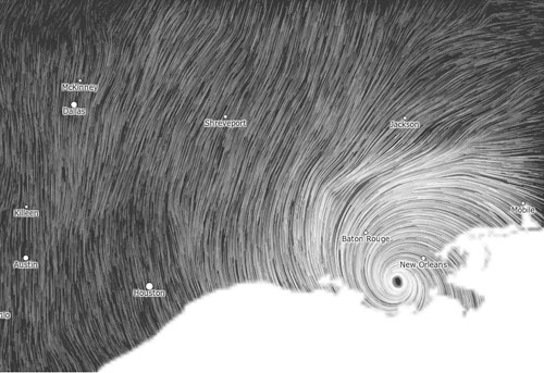
This wind map is generated based on a nearly real-time data from National Digital Forecast Database. It is revised by one hour. Two creators, Fernanda Viegas and Martin Wattenberg implement entire map only with using HTML and Javascript. With this map, people can immediately read the continuously changing flow, density, and direction of winds over all areas of the United States. Also, it highlights a region with the high-speed wind. They depicted the movement of air simply with the visual motion. I admire their work because it is able to communicate the specific types of information to audiences. People might understand what it tells about without many explanations. Also, the quality of quite simple but elegant visualization with motion and black and white color scheme looks really nice and makes me very intriguing to this work.